The EFFECT OF LAND WIDTH ON LAND-SEA BREEZE
By Using WRF.4.0.3 & NCL


CASE1

CASE2
DEFAULT
ANALYZE1
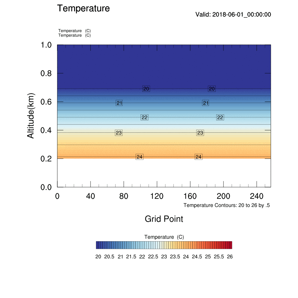
KST: 2018-06-01_15:00:00-16:00:00

Looking at the temperature graph above, the temperature of the ground continues to increase until 15-16 p.m. as long as the temperature is not offset by the collision of the wind.

Figure 1: Diurnal Change of Solar Radiation Flux Density Incident on the Forest Canopy in a Fine Day
Guo Z (2017) Daily Variation Law of Solar Radiation Flux Density Incident on the Horizontal Surface. J Earth Sci Clim Change 8: 412. doi: 10.4172/2157-7617.1000412

Figure 2: Diurnal Temperature Changes in Relation to Energy Gains/Losses
Pearson Prentice Hall, Inc
If you look at Figure 1, you can see that the peak temperature is recorded around 2 o'clock and the temperature is gradually coming down.
As Figure 2 shows, however, the Energy Gain/Loss does not change when the temperature is highest, but the Energy Gain is larger for a while thereafter, so the temperature increases further, hitting the highest point at 4 - 5 p.m., and the Energy Loss starts.
As a result, the temperature of the plot we obtained rises to a high temperature by 4 - 5 p.m. because it is after 4:00 p.m. when the energy loss is bigger than the energy gain.
ANALYZE2
KST: 2018-06-01_14:00:00


KST: 2018-06-01_18:00:00
When the temperature is low, the speed of temperature change is the fastest when the ground is narrow. This is because of these reasons.
(1) Firstly, wide land takes longer for the sea breeze to move inland and ease the energy imbalance.
(2) Also, the wider the land, the greater the heat capacity, the slower the cooling speed.